

A tornado struck Florida on Wednesday, just hours before Hurricane Milton was projected to make landfall, raising concerns about severe weather conditions across the state.
The tornado tore through southern Florida, first appearing just north of Alligator Alley in Collier County. Traffic cameras later captured it making its way near Alligator Alley, just west of Weston in Broward County.
Alligator Alley is a stretch of Interstate 75 in southern Florida running through the Everglades, connecting the western and eastern parts of the state. It spans approximately 80 miles from Naples in Collier County to Fort Lauderdale in Broward County. The name comes from the many alligators inhabiting the wetlands along the route.
Traffic cams caught an impressive tornado passing by Alligator Alley just west of Westin in Broward County this morning. No populated areas were impacted. Outer rain bands from Hurricane Milton could continue to produce tornadoes across parts of Florida. Here’s the timelapse. pic.twitter.com/d0LlGmyA4d
— Brandon Orr (@BrandonOrrWPLG) October 9, 2024
Weather Channel meteorologist Molly McCollum stated during a broadcast that it’s unusual to be able to see tornadoes forming in a tropical environment.
“It is not typical in a tropical tornado environment to have these tornadoes that are so visible, and people being able to see them now has helped, at least in confirming tornadoes,” McCollum said. “We’ve had quite a few confirmations of tornadoes across South Florida so far, and still, a number of tornado warnings are still in progress.
“These have been behaving more like the tornado warnings you’d typically see in the Plains states—Kansas, Oklahoma—those supercell storms, those isolated cells that have really maintained their strength and shown consistent signs of rotation.”
The National Weather Service emphasizes hurricanes have the potential to spawn tornadoes.
“These tornadoes most often occur in thunderstorms embedded in rain bands well away from the center of the hurricane; however, they can also occur near the eyewall. The majority of tornadoes associated with tropical systems occur in the right front quadrant of the storm. This area typically has the best wind shear and instability. Most of the tropical tornadoes that affect central South Carolina and eastern Georgia are from tropical systems that make landfall in the Gulf of Mexico and continue on a path toward the north/northeast. Usually, tornadoes produced by tropical cyclones are relatively weak and short-lived, but they still pose a significant threat,” reads The National Weather Service website.
A tornado watch is in effect until 9 p.m. for areas from north of Fort Myers to the Everglades.
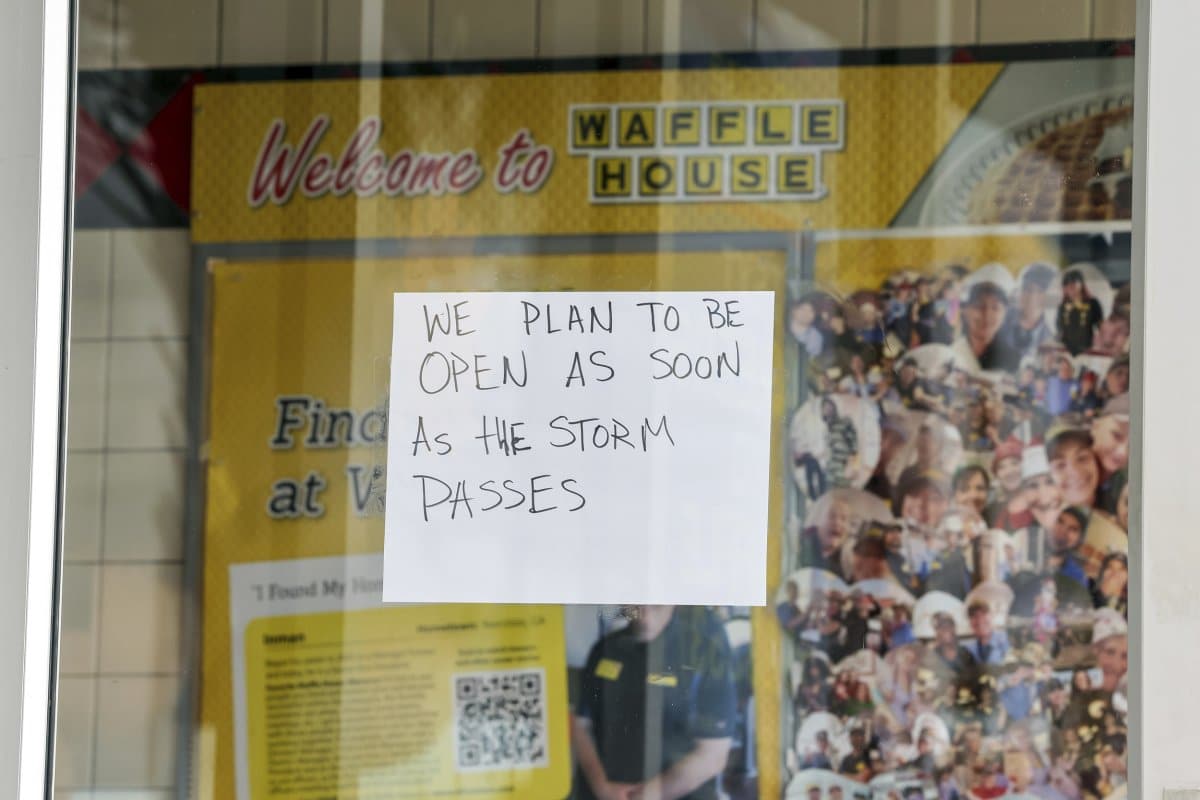
A sign on a closed Waffle House ahead of Hurricane Milton’s landfall on October 8, 2024, in New Port Richey, Florida.
Mike Carlson/AP Photo
Florida has spent the last week gearing up for Hurricane Milton.
Hurricane Milton is expected to make landfall on Florida’s western coast in less than 14 hours, with winds exceeding 100 mph. The storm’s arrival in the night adds to the danger it poses.
President Joe Biden recently spoke about the impending arrival of Milton, highlighting leaders in his administration are on the front lines, actively preparing for the storm.

President Joe Biden speaks during a briefing about preparations for Hurricane Milton and the response to Hurricane Helene at the White House in Washington, D.C., on October 9, 2024.
Mark Schiefelbein/AP Photo
The president announced that he approved an emergency declaration for Florida and deployed search and rescue teams, along with essential supplies like water, food, power generators, and ambulances to the region.
“I want to thank everyone who has followed local guidance to evacuate ahead of landfall,” Biden said. “I urge everyone in Hurricane Milton’s path to adhere to all safety measures as we head into the next 24 hours; it’s a matter of life and death.”
Do you have a story Newsweek should be covering? Do you have any questions about this story? Contact LiveNews@newsweek.com


