Jennifer Boehme grew up scouting beaches around her home in St. Petersburg, Florida, for whatever she could find. Rocks, sand dollars, coquina mollusks – anything the ocean gave up.
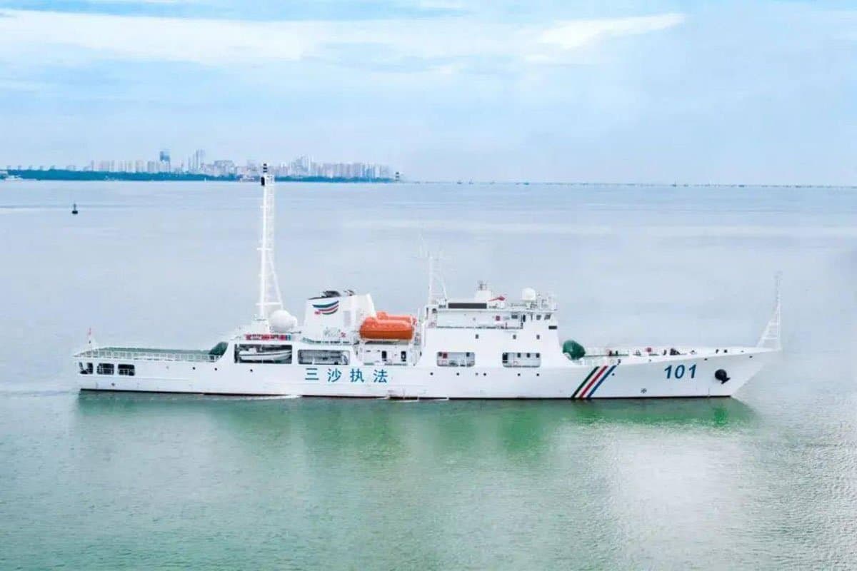
Now, 40 years later, Boehme wants to launch another treasure hunt. As executive director of the Great Lakes Observing System, she’s leading a campaign to map every meter of the lakes’ bottom. The effort, the marine scientist says, will pinpoint hundreds of underwater shipwrecks, illuminate topographical features and locate infrastructure. The map, she says, also will help ships avoid submerged hazards, identify fisheries and inform erosion, storm surge and flooding models as climate change intensifies.
“One of the things that keeps me going is the idea of the discovery aspect of it,” Boehme said. “There’s a lot we don’t know about the lakes. We know more about the surface of the moon.”
Only a fraction of the Great Lakes’ bottom has been mapped, and those low-resolution charts were completed decades ago, according to the Great Lakes Observing System, a non-profit that manages data from a network of lake observers and makes it easily accessible. The National Oceanic and Atmospheric Administration certified the Great Lakes Observing System in 2016 as meeting federal standards for data gathering and management, allowing the federal government to use its data without further vetting.
The organization has been pushing since 2018 to create high-resolution maps of all five Great Lakes bottoms, but that’s a daunting task. The lakes cover 94,250 square miles – an area larger than the state of Kansas. Depths range from 210 feet in Lake Erie to more than 1,300 feet in parts of Lake Superior.
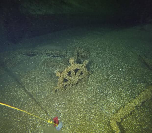
Tamara Thomsen / AP
The idea is gaining traction since technology has improved and scientists have completed high-resolution mapping of Florida coastlines and the Gulf of Mexico over the last three years. Two congressional representatives from Michigan – Republican Lisa McClain and Democrat Debbie Dingell – introduced a bill this year that would allocate $200 million to map the Great Lakes bottoms by 2030.
“I believe it’s time to take exploration and discovery of the Great Lakes into our own hands,” McClain said during a House subcommittee hearing in March.
The last effort to map the lakes came in the 1970s. Maps were largely created using single-beam sonar technology similar to today’s commercially available depth- and fish-finders. The system produced maps covering only about 15% of mostly coastal lake bottom, said Tim Kearns, a spokesperson for the Great Lakes Observing System. With a single sounding every 500 meters (547 yards), the maps were extremely low-resolution and could have missed sink holes, canyons, sand dunes, shipwrecks and infrastructure such as pipelines, cables and intake pipes, Kearns said.
Fast forward nearly a half century. Now scientists and engineers have an array of new mapping tools.
One is multibeam sonar. Rather than sending a single sound wave, these systems bounce potentially hundreds off the bottom. The technology is so sensitive it can detect air bubbles in the water, according to NOAA.
The only drawback is that systems need to be mounted on submersibles or towed under ships to obtain high-resolution images in deep water.
Another tool is laser imaging, where scientists measure how long it takes for a laser beam fired from a plane to reach an object and bounce back, resulting in three-dimensional imaging of bottom topography.
A high-resolution map of the lakebed would offer multiple benefits, said Steven Murawski, a biological oceanographer at the University of South Florida who has done extensive bottom mapping of Florida’s coast and in the Gulf of Mexico.
The Great Lakes map would provide fuller images of bottom features that have changed in the last 50 years due to erosion and shifting sands, giving navigators new depth findings that would improve shipping safety, Murawski said. A map also would help predict how bottom features affect storm surges and flooding as climate change continues, which he said would be invaluable information for insurance companies and municipal planners.
Improved bottom maps also would provide precise locations of infrastructure such as pipelines that have shifted over time, crucial information for dredging and construction projects, Murawski said. He noted he has mapped some 50,000 miles of pipelines in the western Gulf of Mexico and “they’re never where they’re supposed to be.”
Additionally, high-resolution maps would identify underwater outcroppings and ledges where fish tend to congregate, enabling scientists to get better fishery population estimates, the oceanographer added.
“Deadline for our generation”
Fully mapping the lakes for the first time also could reveal the location of hundreds of shipwrecks – some estimates put the number of Great Lakes wrecks at around 6,000 – and relics from ancient coastal civilizations, Boehme said.
Several shipwrecks have already been located in the lakes in recent months. In July, the wreck of the Margaret A. Muir schooner was found off the coast of Wisconsin more than 130 years after it plunged to the bottom of Lake Michigan with the captain’s beloved dog on board.
In April, the Great Lakes Shipwreck Historical Society announced the discovery of the Adella Shores, which sunk to the bottom of Lake Superior with no survivors on May 1, 1909.
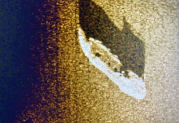
Michigan Shipwreck Research Association
That discovery was announced just weeks after the 1886 wreck of the steamship Milwaukee was found more than 350 below the surface in Lake Michigan.
Just a few months before that, a man and his daughter on a fishing trip found the remains of a ship that sank in Lake Michigan in 1871.
Time is of the essence to locate shipwrecks because many of them become encrusted with invasive species, according to the Great Lakes Shipwreck Historical Society.
“The proliferation of invasive species has now created a time deadline for our generation and for future generations; many shipwrecks have already had so many of their features corrupted by mussels that they have become impossible to study,” the organization says.
Though momentum for mapping is building, Congress hasn’t acted on the financing bill since the March hearing before the House Natural Resources Subcommittee on Water, Wildlife and Fisheries. The subcommittee’s chair, Rep. Cliff Bentz of Oregon, suggested during the hearing that proponents do a better job articulating the value of a new map.
“I know ranking members suggested finding the Edmund Fitzgerald would be a valuable thing but there must be more to it than that,” Bentz said, referring to the freighter that sank in Lake Superior in 1975. The wreckage was actually located days after the ship went down.
Bentz’s spokesperson, Alexia Stenpzas, didn’t respond to an email from The Associated Press seeking comment on the bill’s prospects.
Boehme said she doubts the bill will get traction in an election year, but the Great Lakes Observing System is still working toward its 2030 mapping goal. The group holds an annual conference in Traverse City, Michigan, to discuss progress and test mapping technology and has been reaching out to any boaters willing to take mapping equipment out, providing a look at small chunks of lakebed.
“This research is for a public good,” Boehme said. “The key is persistence and going back again and again and making the case (to Congress). … We need to understand the system so we can conserve it.”